Google wants people around the world to harness the power of their Android phones to create Street View experiences on Google Maps. The company recently announced that you could now add multiple photo spheres—360-degree panoramic images taken with your Android Phone or DSLR camera—to Street View.
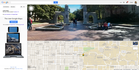
Google already lets you share photo spheres on Google Maps to provide a Street View-like experience. The only difference between a photo sphere and official Street View images is that photo spheres root you to one spot, while Street View lets you move around and navigate to nearby locations on the map. But as of Monday you can connect multiple photo spheres into a complete Street View experience, as you can experience in the Street View below, by Google's Evan Rapoport..
You could use the new feature, for example, to capture nearby scenic views at different times throughout the year. If you wind up taking a vacation in an exotic or hard to reach locale, you could also add multiple panoramic images to Street View. Or maybe you simply want to capture your local town square decked out in Christmas lights.
To read this article in full or to leave a comment, please click here


ConversionConversion EmoticonEmoticon